Crepe Myrtle Cr was the last street to be created in Oak Crest. A large parcel of land that was owned by brothers, J A and H A Nading, and located adjacent to the Fries brothers Oak Crest development, became known as “Nading’s Addition.” This parcel was located along the south side of Polo Rd (formerly Oak Crest Dr) and adjacent to the west border of the original parcel 27 (now Harmon Av) of Oak Crest.
The Nading’s parcel was subdivided into lots 1-74, with the first 8 lots fronting Polo Rd. It was platted by C M Miller, C. E. (Civil Engineer) in April 1937. The lots ranged in size from about 50 – 60 feet across the front and 150 – 190 feet deep (and about 100 feet across the front and 225 feet deep for the lots fronting Polo Rd).
The name of the street comes from the crepe myrtle trees that H A Nading planted along both sides of the street. If you will notice the original spelling of the name on the plat is “Crape Myrtle” with an “a.”
Also, this plat contains an important piece of information. It shows Oak Crest Dr labeled as Polo Rd. In my previous post, Weekly Acorn #36, the plat of the subdivision of Parcel 22 shows the street name as Oak Crest Dr. So, sometime between February 1928 and April 1937 the name Oak Crest Dr was changed to Polo Rd.
Mary Nading McGeehee, daughter of H A Nading, is in her mid nineties and still owns her home on the circle. Hopefully, I will be able provide more information on the Nadings in a later post.
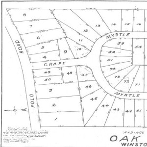
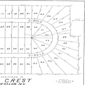

This plat shows the subdivision of Crepe Myrtle Cr from Nading’s Addition into lots (1 – 74). Click on the plat above to view an expanded version or visit the entire Historic Oak Crest Photo Gallery.